Nizao
Nizao is a city in the province of Peravia in the Dominican Republic.
Nizao is a city in the Dominican Republic and capital of the Nizao Municipality. It is the second large municipality of the Peravia Province and is located in southeastern corner of this province, in the angle formed by the estuary of the Nizao River and the Caribbean Sea coast. It is well known for being the city of the luxury cars in the country and they are all owned by "carajitos firmao" as the local people call young professional athletes.
Nizao is a city in the Dominican Republic and capital of the Nizao Municipality. It is the second large municipality of the Peravia Province and is located in southeastern corner of this province, in the angle formed by the estuary of the Nizao River and the Caribbean Sea coast. It is well known for being the city of the luxury cars in the country and they are all owned by "carajitos firmao" as the local people call young professional athletes.
Map - Nizao
Map


Country - Dominican_Republic
 |
 |
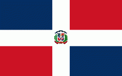
| Flag of the Dominican Republic | |
The native Taíno people had inhabited Hispaniola before the arrival of Europeans, dividing it into five chiefdoms. They had constructed an advanced farming and hunting society, and were in the process of becoming an organized civilization. The Taínos also inhabited Cuba, Jamaica, Puerto Rico, and the Bahamas. The Genoese mariner Christopher Columbus explored and claimed the island for Castile, landing there on his first voyage in 1492. The colony of Santo Domingo became the site of the first permanent European settlement in the Americas and the first seat of Spanish colonial rule in the New World. It would also become the site to introduce importations of enslaved Africans to the Americas. In 1697, Spain recognized French dominion over the western third of the island, which became the independent state of Haiti in 1804.
Currency / Language
| ISO | Currency | Symbol | Significant figures |
|---|---|---|---|
| DOP | Dominican peso | $ | 2 |
| ISO | Language |
|---|---|
| ES | Spanish language |